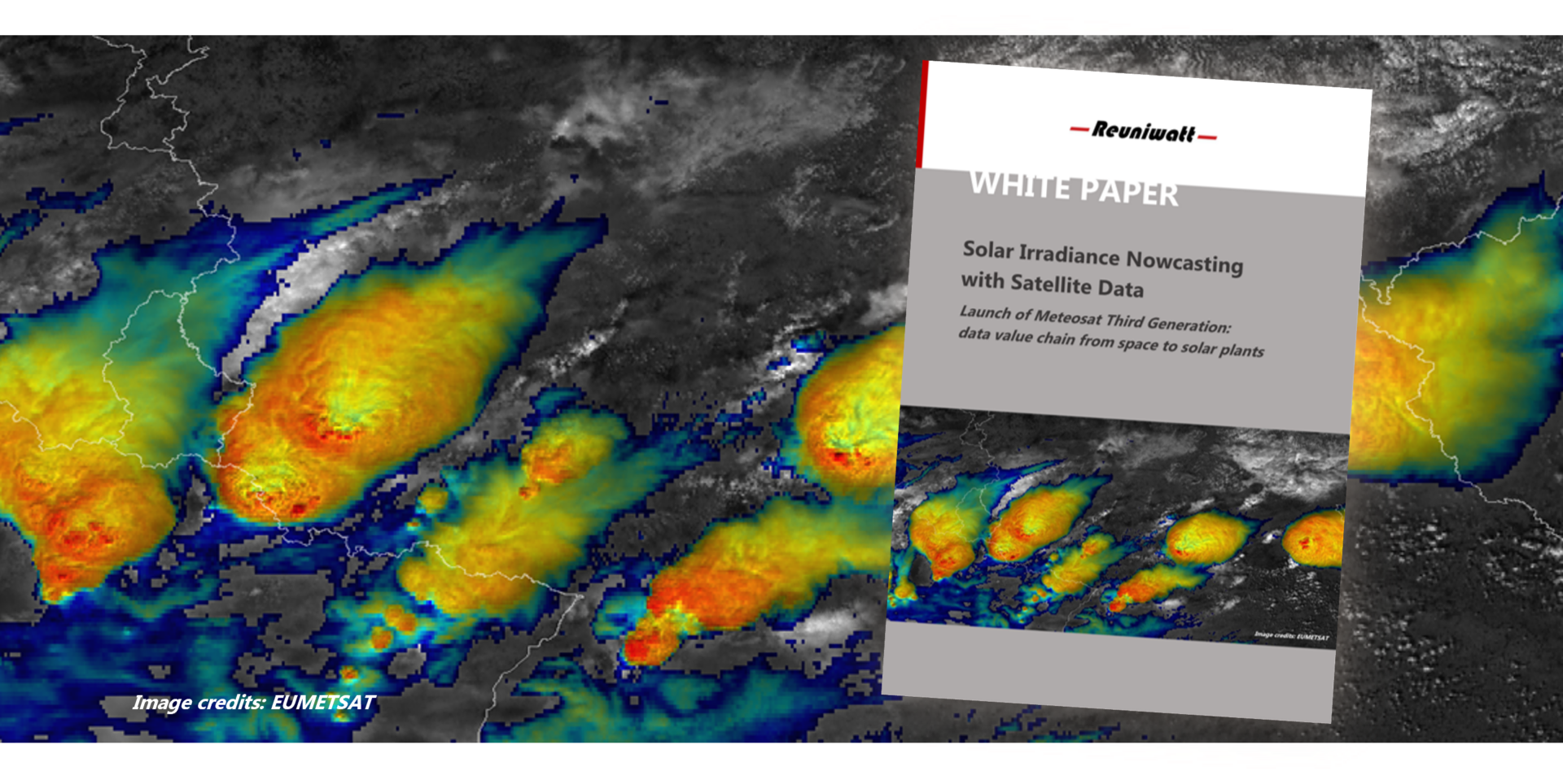
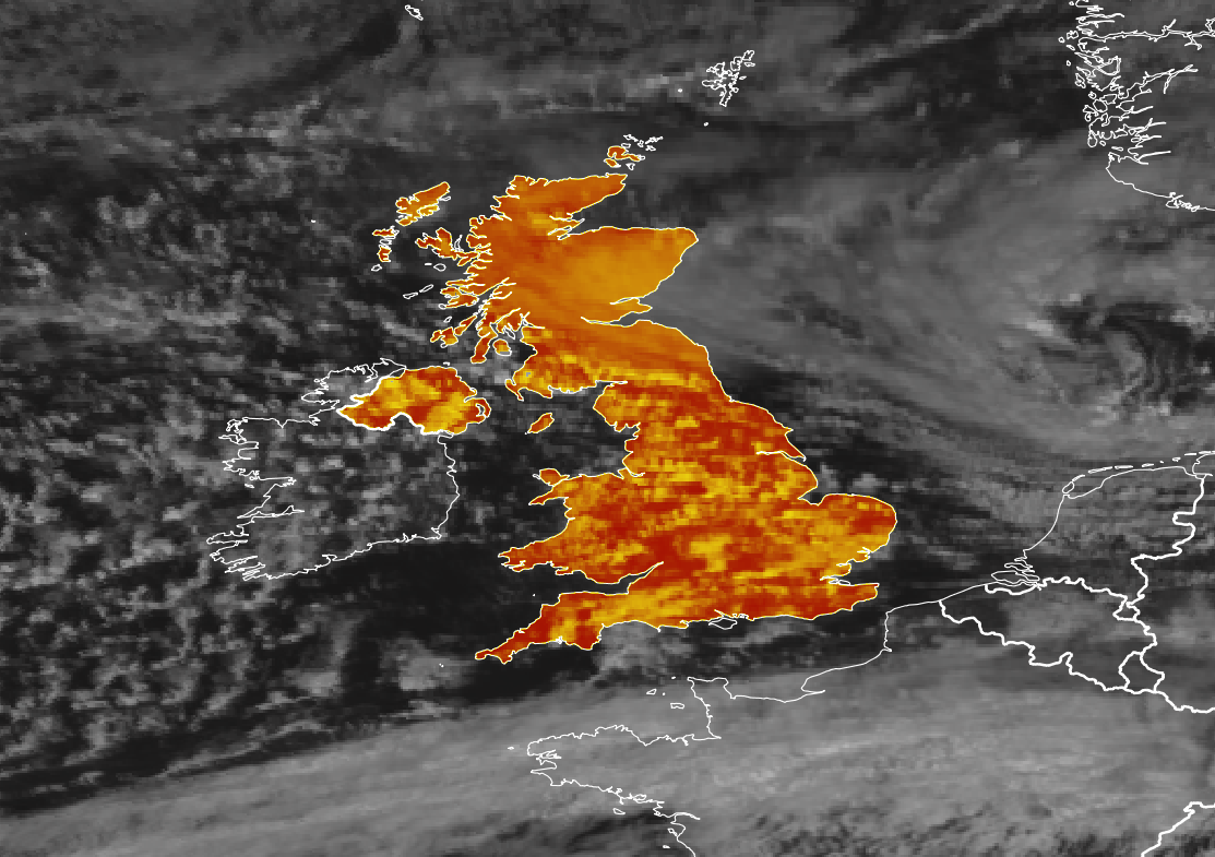
MTG satellite system: Better nowcasts ahead

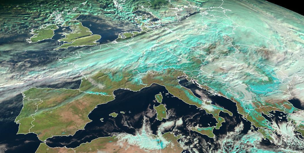
Building on the decades-long legacy of Meteosat’s first- and second-generation satellites, Meteosat Third Generation (MTG) will orbit the Earth at an altitude of 36,000 km with a stable view of Europe and Africa. It's launch offers multiple opportunities outside the space sector. MTG satellite system features and improvements EUMETSAT has provided society with more than three decades worth of satellite data, starting with the

IGNfab: Cooperation with the Territoire Paris Est Marne&Bois

This year, the Territoire Paris Est Marne&Bois and the team of PCAET (Plan Climat Air Énergie Territorial) together with two partner incubators, GreenTech Innovation and IGNfab, are initiating the possibility for awarded start-ups to get involved with the Territoire services and interested cities to jointly develop innovative green projects. The collaboration also supports Reuniwatt's innovative PARCS mapping. As part of its mission to support

Reuniwatt’s PARCS selected for the latest edition of the IGNfab

Reuniwatt has developed an innovative technique for surveying solar installations from the sky: The PARCS project facilitates the integration of variable energies in the local electricity grid and was selected for the latest edition of the IGNfab, which will allow for a win-win exchange between the IGN and Reuniwatt. Our society has to respond to many challenges in the field of sustainability and mobility,

Pollutec 2016: get your free badge and book a meeting

Come meet us at Pollutec 2016, the 27th international exhibition of environmental equipment technologies and services in Lyon, from 29th November-2nd December. Pollutec brings together professionals from around the world to discuss about innovative solutions that allows the reduction of the impact of human activities on the environment, whether it be in industry, local authorities or in the service sector. As an actor of

Eumetsat 2016: Solar forecasting presentation at the Meteorological Satellite Conference

  The 2016 EUMETSAT Meteorological Satellite Conference will take place in Darmstadt, Germany from 26 to 30 September 2016. Reuniwatt will present its recent work on solar forecasting using satellite images. For its 30th anniversary, the European Organisation for the Exploitation of Meteorological Satellites (EUMETSAT) organizes its annual scientific conference in its hometown Darmstadt (Germany) from 26 to 30 september 2016. A special opportunity for this

EMS 2016: Forecasting the solar generation in insular areas

At the occasion of its 16th Annual Assembly, which will take place in Trieste (Italy) from September 12.-16. 2016, the European Meteorological Society (EMS) focuses on coastal meteorology. Given the fact that nearly 40% of the European population lives within 50 km from coasts, the quality of weather forecasts is crucial since it largely impacts the safety and the economic activity of insular and littoral areas. As a solar generation

How the solar eclipse challenged the electricity grid in La Réunion

On September 1st, 2016, Reunion Island was on the front row to witness an extraordinary astronomical show: an annular eclipse. How did this rare event impact the photovoltaic generation, and the management of the local power grid? The Moon gradually blotted out the Sun in the morning of September 1st, successively casting its shadow from Equatorial Africa to the south of the Indian Ocean. Located

Forecasting irradiance using satellite imagery

Reuniwatt places its skills in utilising satellite images in order to provide the most accurate solar irradiance forecasts. Its latest research in this field will be presented at the next EU PVSEC conference, the largest international Conference for Photovoltaic research, technologies and applications, which will take place in Hamburg, Germany, from 14-18 September. Assessing past PV productions Reuniwatt provides accurate irradiance data thanks to

Satellite imagery for a successful energy transition

The relationship between satellite images and renewable energy sources (RES) is not necessarily easy to pinpoint. However, the use of satellite imagery is crucial to achieve a successful energy transition! Indeed, the latter enable to map, monitor and forecast the solar irradiance reaching Earth. It is of prime importance to geo-locate the appropriate photovoltaic (PV) implementation areas and to identify in real time a territory’s

Go to Top