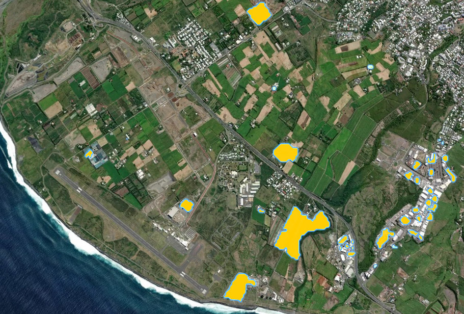
Reuniwatt has developed an innovative technique for surveying solar installations from the sky: The PARCS project facilitates the integration of variable energies in the local electricity grid and was selected for the latest edition of the IGNfab, which will allow for a win-win exchange between the IGN and Reuniwatt.
Our society has to respond to many challenges in the field of sustainability and mobility, and find operational solutions. To allow a better grid integration of renewable installations, Reuniwatt has developed the high-performance service, PARCS, for a precise and updated cartography of solar installations based on satellite and aerial image processing. PARCS will facilitate the monitoring of solar installations, and on the long run, help local authorities better anticipate variations in PV production.
Developing geoservice projects for French territories
IGN, the French National Geographic Institute, is the public operator for geographic and forest information in France. The institute’s IGNfab programme establishes partnerships between the institute and innovative companies to develop digital products and services using land description and geolocation in the sectors of environment, land use planning, urban planning, agriculture, forestry, energy, transport, defense and security, among others. For its 2021 IGNfab edition, selected Reuniwatt to benefit from the expertise, network support and data #GéodataPourLeClimat of the IGN. The partnership will enable Reuniwatt to use the IGN’s data and techniques. With its IGNfab progamme, the institute aims to give the selected companies the opportunity to accelerate the development of their projects. Reuniwatt’s advanced expertise and high-level innovation will help strengthen the institute’s position as a recognized scientific and technical centre and as one of the players of France’s digital transformation.
Satellite and aerial images to map solar installations
Building on years of experience in using data from high-resolution earth observation provided by satellites to deliver accurate local irradiance data, Reuniwatt’s PARCS will make it possible to obtain the most complete, accurate and up-to-date map of the solar installations in a chosen area. The methodology is well adapted to the French territories.
Within the framework of the deployment and performance monitoring, this atlas of solar installations will be exploitable in a standard GIS format (Geographic Information System). It allows for:
- An overview of the photovoltaic installations on the territory, as well as their distribution
- A decision support tool for identifying the focus areas for the penetration of renewable energies
- An annual monitoring of the evolution of the solar park
- An assistance in determining additional indicators for steering and monitoring the application during the development phase.
Reuniwatt is proud to cooperate with IGNfab with the goal to provide the most complete, accurate and up-to-date solar installation maps across France, and eventually, across the world.
About Reuniwatt (www.reuniwatt.com)
Reuniwatt is a major player of the solar radiation and cloud cover assessment and forecasting. Based on solid Research and Development works, the company offers reliable products and services intended for professionals of various fields, making the best out of two key facets of the meteorology: atmospheric physics and data sciences. A particular focus has been placed on solar energy forecasting, while developing cutting edge solutions to improve the short-term prediction of the solar resource.
The company has won many grants, including H2020’s SME Phase 1 programme, which makes Reuniwatt a European Champion with regard to innovation. Reuniwatt has also been selected among the national fast-growing companies to join the prestigious French Tech 120 programme in 2020, and remains a part of the selection for 2021.
